


The official Bay Area wildfire risk map is available through two primary sources: the CAL FIRE/OSFM Fire Hazard Severity Zone (FHSZ) Viewer and the CNRA GIS Data Portal. Use the FHSZ Viewer first — it accepts a street address and returns your property’s official hazard designation within seconds. The single most important thing to understand before you read any color on the map: these maps measure landscape-level hazard, not a property-specific prediction of loss or insurance outcome. A Very High designation tells you the surrounding terrain, fuels, and wind patterns create dangerous fire conditions. It does not tell you whether your house will burn or what your insurer will charge.
Here is what to do right now:
- Enter your address in the FHSZ Viewer and note your zone (Moderate, High, or Very High).
- Check whether your parcel falls in a State Responsibility Area (SRA) or Local Responsibility Area (LRA) — this determines which regulations apply and when.
- Save a screenshot of the map result for your records, and share it with your agent or insurer if the designation is unexpected.
| Quick Reference | Details |
|---|---|
| Primary viewer | CAL FIRE/OSFM FHSZ Viewer (address lookup) |
| Raw GIS data | CNRA GIS Data Portal (downloadable feature services) |
| SRA data effective | April 1, 2024 |
| LRA recommended maps | Published March 24, 2025 |
| What maps measure | Landscape-level hazard, not property-level risk |
Key Takeaways
FHSZ maps measure landscape-level hazard — not property-level risk — and the 2024–2025 update expanded High and Very High designations across many Bay Area jurisdictions, making it more important than ever to check your address and act on the result.
| Point | Details |
|---|---|
| Check your address first | Use the CAL FIRE/OSFM FHSZ Viewer for your official zone designation before any other step. |
| Hazard is not the same as risk | The map shows landscape conditions; your insurer uses a separate proprietary model that may rate your property differently. |
| SRA vs. LRA timing matters | SRA maps are effective as of April 1, 2024; LRA recommended maps were published March 24, 2025 and require local adoption. |
| Act on your designation | Prioritize ember-resistant vents and a Class A roof — the upgrades most likely to affect insurer scoring and buyer confidence. |
| Kenneth Hogan | We help Bay Area buyers and sellers verify FHSZ status, handle disclosures, and plan home-hardening upgrades that support a successful transaction. |
Table of Contents
- Where can you find the official Bay Area wildfire risk maps?
- What do FHSZ maps actually measure — hazard or risk?
- How to look up your address and read the results
- SRA vs. LRA: what the adoption timeline means for your property
- What the maps mean for homeowners: insurance, codes, and disclosures
- Concrete steps to lower your actual fire risk now
- How FHSZ maps are made — and why the 2024–2025 update expanded coverage
- A Bay Area real-estate perspective on using these maps
- How Kenneth Hogan helps Bay Area property owners in hazard zones
- Sources
Where can you find the official Bay Area wildfire risk maps?
Several official sources cover Bay Area fire hazard mapping, and each serves a different purpose. Knowing which viewer to open first saves time and prevents confusion.
1. CAL FIRE/OSFM FHSZ Viewer — the starting point for most property owners. Type in your address, and the viewer returns your official Fire Hazard Severity Zone designation along with jurisdiction type (SRA or LRA). This is the authoritative state source for disclosure and building-code purposes.
2. CNRA GIS Data Portal — the right tool if you need raw data. The portal hosts the FHSZ feature services, including the SRA dataset (effective April 1, 2024) and the recommended LRA dataset (published March 24, 2025). GIS professionals, planners, and researchers can download these layers directly for analysis.
3. County and local fire department viewers — useful for confirming local adoption status. Alameda County Fire, for example, maintains a hazard locator that reflects county-level interpretation alongside links to state resources. Santa Clara County Fire posts LRA maps and adoption schedules with deadlines for public input.
4. Regional planning resources — ABAG and the Diablo Firesafe Council provide supplemental hazard layers with historical fire perimeter overlays, which add useful regional context beyond the state FHSZ boundaries.
| Viewer | Best Used For | Immediate Action |
|---|---|---|
| CAL FIRE/OSFM FHSZ Viewer | Address lookup, zone designation | Enter your address; note zone and SRA/LRA status |
| CNRA GIS Data Portal | Downloading GIS layers, raw data | Download SRA or LRA feature service for analysis |
| County/local viewers | Local adoption status, local guidance | Check your county fire department’s page |
| ABAG / Firesafe Council | Regional context, fire history overlays | Review historical perimeters near your parcel |
What do FHSZ maps actually measure — hazard or risk?
The distinction matters more than most people realize. CAL FIRE and the Office of the State Fire Marshal (OSFM) are explicit: FHSZ maps evaluate hazard, not risk. Hazard describes the physical conditions in the landscape that make a major wildfire more likely over decades — fuel loading, slope, prevailing winds, and fire weather patterns. Risk, by contrast, accounts for what is exposed to that hazard and how vulnerable it is, including your specific structure, its construction materials, and its surroundings.
Think of it the way OSFM describes it: FHSZ maps are analogous to FEMA flood maps. They identify where conditions favor a major event, not whether your particular house will be damaged.
The three zone categories:
- Moderate: Lower fuel density or terrain that limits fire spread; still subject to wildfire but with less severe expected behavior.
- High: Significant fuel loads, steeper slopes, or wind exposure that produce more intense fire behavior under typical dry-season conditions.
- Very High: The most severe combination of fuels, terrain, wind corridors, and fire history; structures here face the greatest ember exposure and flame-length potential.
What drives a designation:
- Fuel loading (type, density, and continuity of vegetation)
- Slope (steeper terrain accelerates fire spread)
- Fire weather and wind corridors (seasonal patterns, Diablo winds)
- Historical fire perimeters and ignition frequency
- Expected ember transport distance and behavior
- Flame length modeling under design-fire conditions
How to look up your address and read the results
The FHSZ Viewer is straightforward to use, but a few steps make the result more useful.
- Open the CAL FIRE/OSFM FHSZ Viewer in a desktop browser for the clearest map display.
- Type your full street address into the search bar and press Enter. The map will center on your parcel.
- Read the color overlay on your parcel: yellow (Moderate), orange (High), or red (Very High). If your parcel shows no color, it may fall outside a designated zone or in an area not yet adopted.
- Check the jurisdiction label. The viewer indicates whether your parcel is in an SRA or LRA. This affects which building codes and regulations apply to you.
- Toggle available layers — look for adoption status overlays and county boundary lines to understand whether your local government has formally adopted the recommended LRA map.
- Zoom out to see neighboring parcels. A property sitting on a zone boundary may carry different practical implications than one clearly inside a single zone.
Common map artifacts to watch for: Parcels on zone boundaries sometimes show split designations; the more restrictive zone typically governs for building and disclosure purposes. Water bodies and recently burned areas may not reflect current fuel conditions, since the model uses vegetation data from the update cycle rather than real-time fuel moisture.
Pro Tip: Take a dated screenshot of your parcel’s designation and save it to your property records folder. If your designation changes in a future update cycle, having the prior map on file is useful documentation for insurance conversations and disclosure history.
If your designation looks wrong — for example, your parcel is flagged Very High but sits on a paved lot with no surrounding vegetation — you can contact OSFM directly at [email protected] to request a review. Submitting site-specific evidence (photos, fuel surveys) strengthens a review request. Local jurisdictions can increase hazard levels but generally cannot lower a state-identified designation without substantial supporting evidence.
SRA vs. LRA: what the adoption timeline means for your property
Understanding who is responsible for your parcel is the key to knowing which rules apply and when.
State Responsibility Area (SRA): CAL FIRE is the primary fire protection agency. SRA FHSZ maps became effective April 1, 2024, meaning building codes, defensible space requirements, and disclosure obligations tied to those designations are already in force for SRA parcels.
Local Responsibility Area (LRA): Cities and counties are the primary fire protection agencies. OSFM published recommended LRA maps on March 24, 2025. Local jurisdictions then review those recommendations, hold public comment periods, and formally adopt or modify them through ordinance, following California Government Code requirements. Until a local government formally adopts the recommended map, the LRA designation is recommended but not yet legally binding for local permitting purposes.
The OSFM/CAL FIRE FAQ explains this process in detail, including how local jurisdictions may increase designations but face a high bar for reducing them.
| Dimension | SRA | LRA |
|---|---|---|
| Primary fire agency | CAL FIRE | City or county fire department |
| Map effective date | April 1, 2024 | Recommended March 24, 2025; adoption varies by jurisdiction |
| Who enforces building codes | State (CAL FIRE) | Local building and fire departments |
| Disclosure obligation | Active now | Active now for recommended zones; local adoption affects permitting triggers |
| Where to check status | FHSZ Viewer | County fire department or planning department page |
- Bay Area counties including Santa Clara, Alameda, and Marin are at various stages of reviewing and adopting LRA maps.
- Residents can participate in public comment periods before local adoption — check your county fire department’s website for scheduled hearings.
- Once adopted, LRA designations trigger the same building material and defensible space requirements that already apply in SRA zones.
What the maps mean for homeowners: insurance, codes, and disclosures
A Very High FHSZ designation on your parcel has real, practical consequences across three areas.
Building codes and permits: Properties in High and Very High zones are subject to California’s Chapter 7A building standards, which require ignition-resistant construction materials for new builds and certain remodels. If you are planning an addition or major renovation, your local building department will apply these standards based on your FHSZ designation.
Mandatory disclosures: California law requires sellers to disclose a property’s FHSZ designation to buyers. This applies in both SRA and LRA zones. Failing to disclose is a legal liability, and buyers increasingly request this information early in the transaction.
Insurance: This is where the map’s limits become most visible. Insurers use proprietary, property-level wildfire risk models that weigh factors the state FHSZ map does not capture — building density, structure-to-structure spread potential (conflagration risk), roof type, vent screening, and defensible space condition. A property in a Moderate FHSZ zone can still receive a high insurer risk score if it sits in a dense neighborhood with wood-shake roofs and no ember-resistant vents. Conversely, a well-hardened home in a Very High zone may fare better with some carriers than a poorly maintained home in a High zone.
Services like First Street Foundation provide city-level wildfire risk data that can supplement official maps for a more localized picture.
Immediate actions for homeowners:
- Pull your official FHSZ designation from the viewer and share it with your insurance agent.
- Ask your insurer which proprietary risk model they use and how your property scores on their scale.
- Budget for potential home-hardening upgrades — these can meaningfully affect both insurer scoring and buyer perception at sale.
- If you are selling, confirm your disclosure obligations with your listing agent before going to market.
Concrete steps to lower your actual fire risk now
Knowing your zone is the first step. Acting on it is what changes your outcome. These priorities are drawn from CAL FIRE guidance and fire-safe council recommendations for Bay Area property owners.
- Create and maintain defensible space. California law requires 100 feet of defensible space around structures in SRA and adopted LRA zones. Zone 0 (0–5 feet) should be non-combustible: gravel, concrete, or bare soil. Zone 1 (5–30 feet) requires lean, clean, and green vegetation management. Zone 2 (30–100 feet) focuses on reducing fuel continuity.
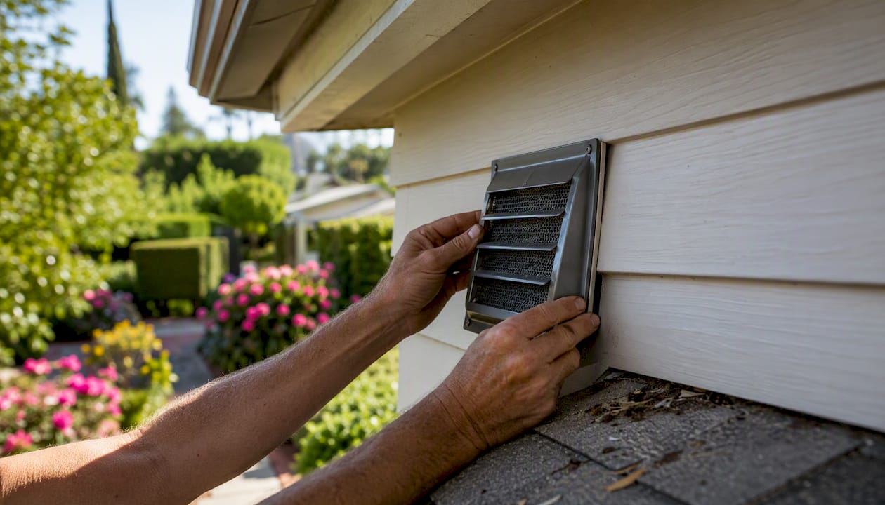
- Install ember-resistant vents. Ember intrusion through standard vents is one of the leading causes of structure ignition. Replacing vents with 1/16-inch mesh or IBHS-rated ember-resistant models is one of the highest-value upgrades per dollar spent.
- Address your roof and gutters. Class A fire-rated roofing (tile, metal, or composition shingles) and metal gutter guards that prevent debris accumulation reduce ignition risk significantly.
- Replace combustible decking and fencing near the structure. Wood decks and fences that connect directly to the house act as fire pathways. Composite decking or a non-combustible break at the structure connection reduces this pathway.
- Post clear address signage. Visible, reflective address numbers at the driveway entrance allow fire crews to locate your property quickly during an emergency.
- Build and practice an evacuation plan. Know at least two exit routes from your neighborhood and sign up for your county’s emergency alert system (e.g., AC Alert for Alameda County, SCC Alert for Santa Clara County).
Local programs and grants are available to offset costs. The Diablo Firesafe Council connects East Bay homeowners with fuel reduction programs and chipping services. Bay Area Air Quality Management District programs sometimes fund vegetation management in high-hazard areas.
For homeowners considering structural upgrades or ADU additions in hazard zones, fire-resistant construction approaches and ADU permitting considerations in hazard zones are worth reviewing before breaking ground.
Pro Tip: Ember-resistant vents and a Class A roof together are the two upgrades most likely to shift an insurer’s property-level risk score. Start there before investing in landscaping changes, which are harder for insurers to verify remotely.
How FHSZ maps are made — and why the 2024–2025 update expanded coverage
The FHSZ model is built on a set of physical inputs that CAL FIRE and OSFM combine to estimate fire behavior across the landscape. Understanding the model helps you trust the map and recognize its limits.
Core model inputs:
- Fuel type, density, and moisture (vegetation datasets updated for each mapping cycle)
- Terrain slope and aspect (steeper, south-facing slopes carry higher scores)
- Local fire weather, including wind speed, direction, and seasonal patterns
- Ember transport modeling (how far and in what density embers travel under design-fire conditions)
- Historical fire perimeters and ignition frequency data
The 2024–2025 update cycle produced materially larger mapped hazard areas across California, including many Bay Area jurisdictions. CalMatters reporting documents how the update expanded High and Very High designations in numerous counties. Two factors drove this expansion: improved modeling tools — including hyperlocal weather simulations and updated ember transport algorithms — and a statutory change requiring that all three hazard tiers (Moderate, High, and Very High) be mapped in LRA for the first time.
The 2024–2025 FHSZ mapping cycle used improved hyperlocal weather simulations, updated fuel datasets, and ember modeling, combined with a policy change requiring all three hazard tiers to be mapped in Local Responsibility Areas — producing significant map expansion across many Bay Area zones.
Raw GIS data packages for both SRA and LRA are available through the CNRA GIS portal, allowing planners, researchers, and advanced users to inspect the underlying feature services directly. Regional context and historical fire perimeter overlays are available through ABAG’s wildfire research pages.
A Bay Area real-estate perspective on using these maps
We use FHSZ maps at the start of every transaction involving a property in the hills or interface zones — not as a final verdict, but as a starting framework. The map tells us the landscape context. The structure, its materials, and its maintenance tell us the rest.
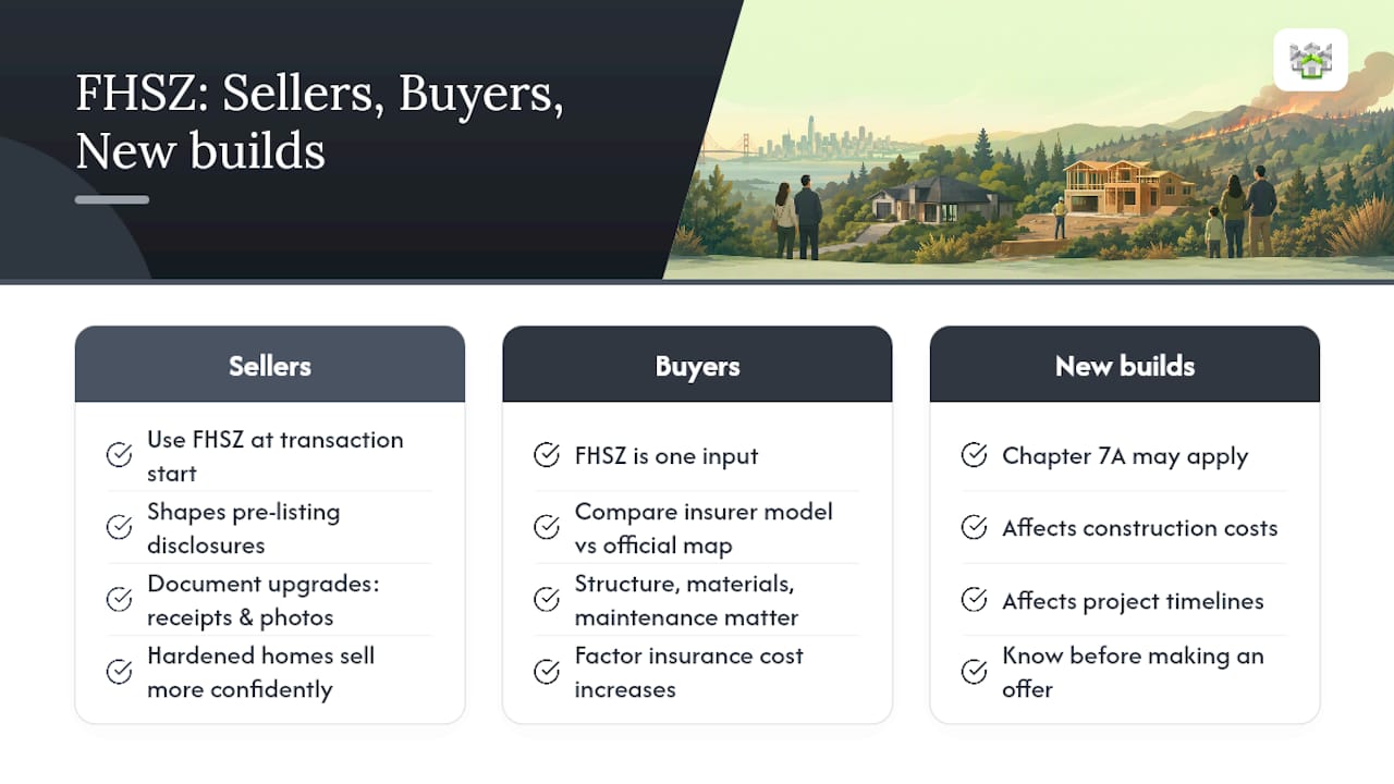
For sellers, the designation shapes the disclosure conversation before listing. A Very High zone property that has been properly hardened — Class A roof, ember-resistant vents, maintained defensible space — presents very differently to buyers than one that has not. We advise sellers to document every upgrade with receipts and photos, because buyers and their agents will ask, and insurers will want the same evidence. Staging and preparation matter here too; a well-presented, well-documented home in a hazard zone sells more confidently than one where buyers are left guessing about its condition. Our home staging and preparation guidance covers how to present these improvements effectively.
For buyers, the FHSZ designation is one input among several. We walk clients through the official map, then help them understand what their insurer’s proprietary model may show — because those two numbers often differ. A property in a High zone with a favorable insurer score and a well-maintained structure can be a sound purchase. A property in a Moderate zone with a dense wood-shake neighborhood and no ember protection may carry more practical risk than the official map suggests. Buyers financing in hazard zones should also factor potential insurance cost increases into their budget; our guidance on navigating financing costs addresses how to build those variables into an offer strategy.
The scenario where designation matters most is a new build or major remodel triggering Chapter 7A requirements. In those cases, the FHSZ designation directly affects construction costs and timelines, and buyers need to know that before making an offer.
How Kenneth Hogan helps Bay Area property owners in hazard zones
Checking the official map is the right first step. Knowing what to do with the result is where we come in.

At Kenneth Hogan, we work with buyers and sellers across Berkeley and the Greater Bay Area who are navigating FHSZ designations every day. We verify your property’s official zone status, coordinate with inspectors who understand Chapter 7A requirements, and advise sellers on which home-hardening upgrades improve both saleability and insurer perception before listing. For buyers, we review disclosure packages carefully and help you understand the gap between the state hazard map and what your insurer’s model may show — so there are no surprises after closing.
Whether you are selling a hillside home that needs a clear disclosure strategy, buying in a High or Very High zone for the first time, or managing a multi-unit property across multiple parcels, our residential real estate services are built around the local knowledge that makes these transactions go smoothly. Reach out to schedule a consultation and get a clear picture of what your property’s designation means for your next move.
Sources
These are the primary sources to consult for address lookups, GIS data, adoption timelines, and appeals.